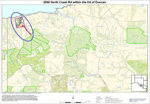
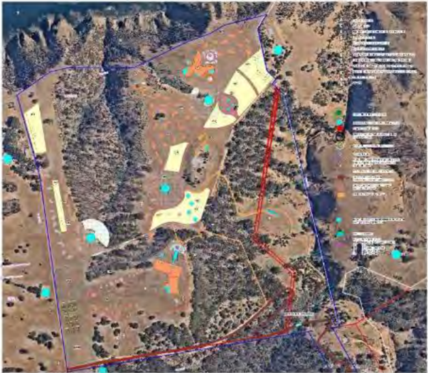
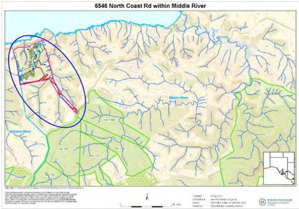
Maps of proposed development
Until the development application was published on 2 January, the only maps available were taken from the Data report prepared on behalf of the proponent for the purpose of seeking approval to clear state-significant native vegetation.
(For Melbourne Architectural Firm Junctions 90 Pty Ltd, 11 August 2025)
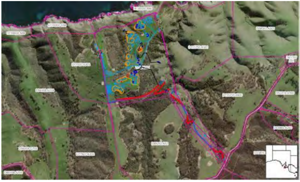
Now the application documents have been published on Plan SA, we have added a new map below. It indicates that the proponent has altered the proposed access point to the property from the Eastern ‘axe-handle’ to a Western easement, however while the application is for approval for a 12.5m wide track, it is understood the easement allows only for 10m. The creation of a 12.5m wide access track on the existing easement would require clearance of native vegetation and habitat.
Please read the proponent’s report and application documents on Plan SA for yourself but our personal concern is that they do not adequately represent the sensitivity and importance of the habitat nor the ‘known or likely’ presence of nationally-listed threatened species, nor does it address the cumulative environmental and other impacts on the local community that would be associated with a proposed development of this scale and intensity in a remote and environmentally sensitive and significant site.
Map taken from original application for Native Vegetation Clearance approval
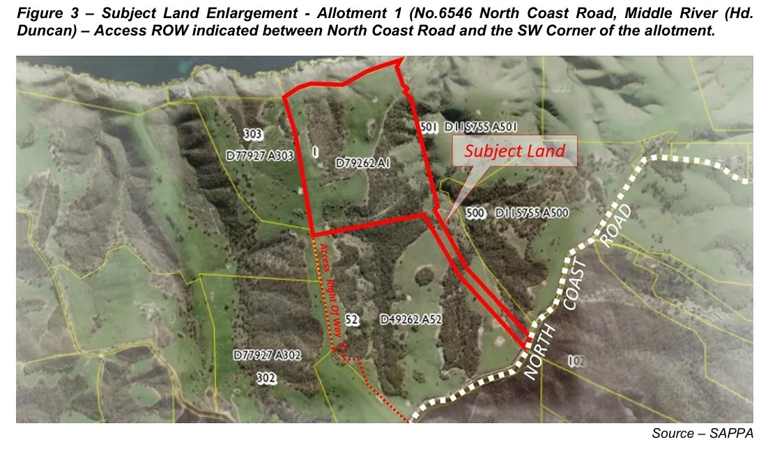
Revised map taken from application for Plan SA approval - ‘Access Right of Way’ in red text/dotted yellow/red line
The maps are difficult to interpret but give an indication of the location, scale and intensity of development proposed for this environmentally sensitive area.